College of DuPage - 6km Resolution Composite Radar

From: http://weather.cod.edu/

SFWMD - Florida Radar Loop

From: http://www.sfwmd.gov

NWS Radar Images

From: http://www.srh.noaa.gov/port/

 From: http://www.wjhg.com/templates/2015_Fullscreen_Radar

Full Resolution Link: NWS Enhanced National Mosaic Radar Loop

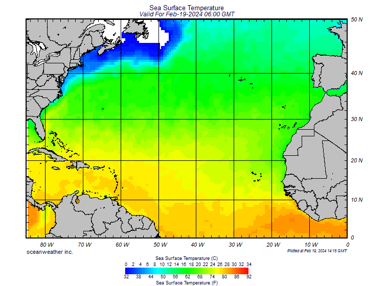
From: http://www.oceanweather.com/data/

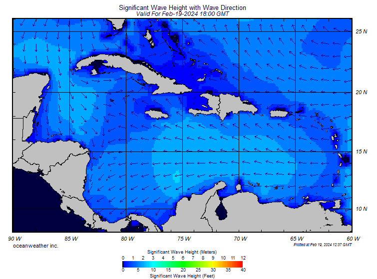
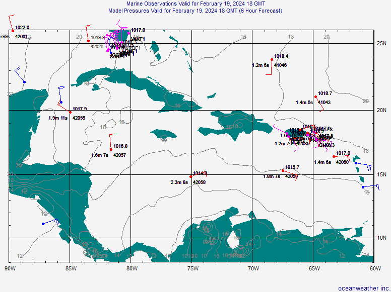
Conversion Chart: http://www.boatsafe.com/tools/meter.htm


From: http://www.wpc.ncep.noaa.gov/

National Weather Hazards

From: http://www.weather.gov/

From: http://www.spc.noaa.gov/products/wwa/
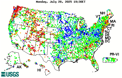
USGS Real-Time

From: http://waterdata.usgs.gov/nwis/rt

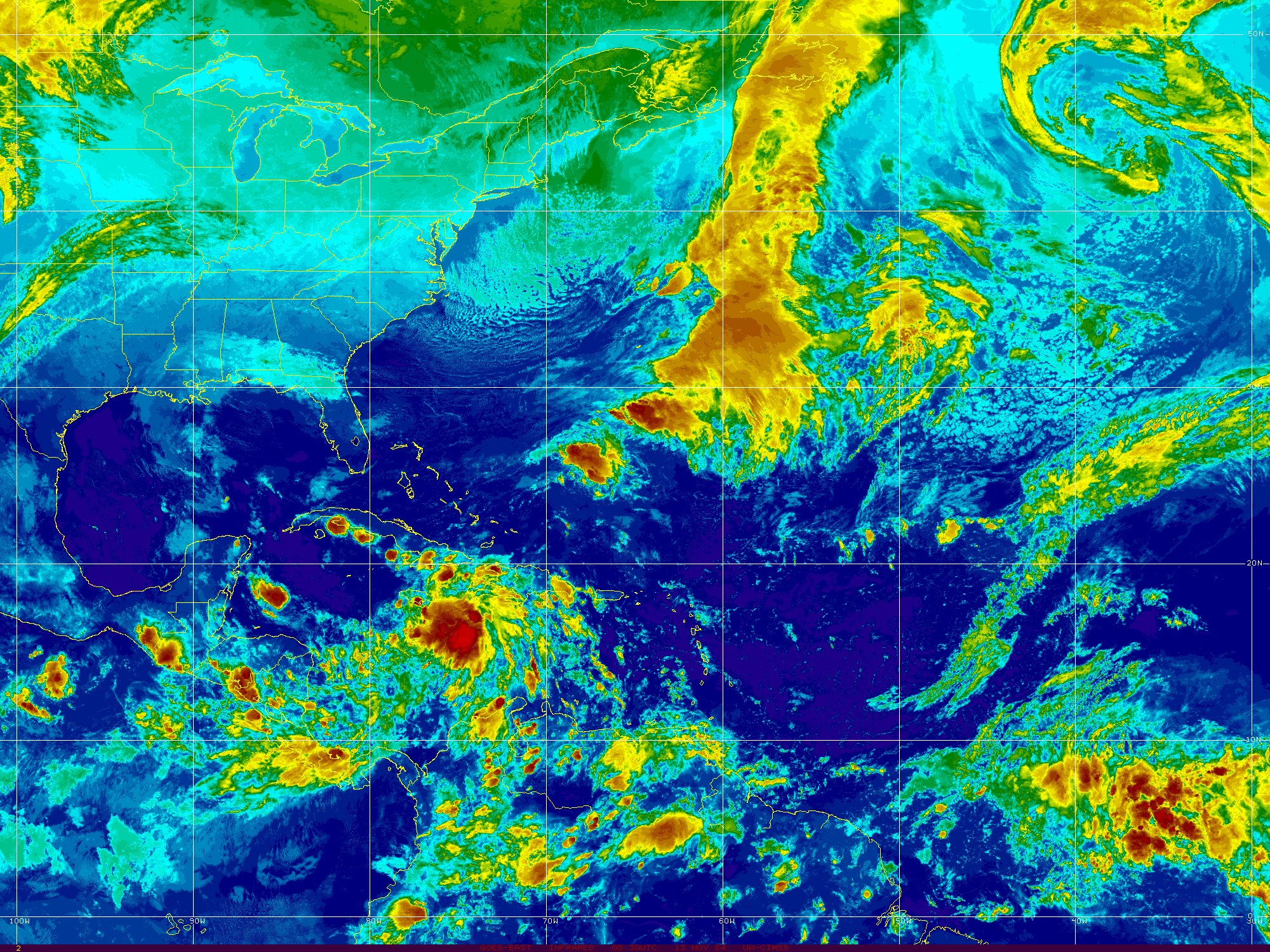
 From: https://www.star.nesdis.noaa.gov/GOES/index.php


From: http://tropic.ssec.wisc.edu/


Interactive NexSat / GOES Weather Satellite Images

From: https://www.nrlmry.navy.mil/NEXSAT.html

Interactive Global Geostationary Weather Satellite Images

From: http://weather.msfc.nasa.gov/GOES/

TROPICAL WEATHER OUTLOOK

SPANISH TROPICAL WEATHER OUTLOOK

TROPICAL WEATHER DISCUSSION

ATLANTIC - Tropical Surface Analysis

0000 UTC
(GIF image)

0600 UTC
(GIF image)

1200 UTC
(GIF image)

1800 UTC
(GIF image)


Latest Full Earth

Full Earth Africa

Florida


Tides, Currents, Bouy Information

https://tidesandcurrents.noaa.gov/inundationdb/storm/Dorian.html

http://www.ndbc.noaa.gov/radial_search.php?storm=at5

https://slosh.nws.noaa.gov/psurge2.0/index.php?S=Dorian2019


New Orleans, LA - Various

http://www.nola.com/

http://www.weatherserver.net/hurricanecenter/

http://water.usgs.gov/waterwatch/

http://waterdata.usgs.gov/nwis/rt

http://nowcoast.noaa.gov/

http://ahps.srh.noaa.gov/index.php?wfo=lix

http://www.srh.noaa.gov/lmrfc/qpfpage.shtml#qpf

http://www.srh.noaa.gov/lmrfc/

http://www.srh.noaa.gov/ahps/maps/ahps_text.php?site=lix

http://weather.gov/rivers_tab.php

http://maps.google.com/maps?q=new+orleans

http://mapper.cctechnol.com/floodmap.php

http://ngs.woc.noaa.gov/katrina/KATRINA0000.HTM


Various Links

http://www.crownweather.com/

http://cimss.ssec.wisc.edu/goes/goesdata.html

https://goes.gsfc.nasa.gov/

http://weather.net-waves.com/tropics.php

http://cat5.nhc.noaa.gov/Hwind/AnalysisOutput.html

http://www.cira.colostate.edu/ramm/rmsdsol/TROPICAL.html

http://tbone.biol.sc.edu/tide/sitesel.html

http://moe.met.fsu.edu/tcgengifs/

http://moe.met.fsu.edu/~acevans/models/

http://www.flamedia.com/lightning/light.htm

http://www.atwc.org/p2.php#buoy

http://www.srh.noaa.gov/port/

http://www.meteo.psu.edu/%7Egadomski/RAD_HUR/animauto.html

http://www.sfwmd.gov/curre/3_radar.html

http://www.sfwmd.gov/org/omd/ops/weather/noaaport/radar_sat_anim.gif

http://www.sfwmd.gov/org/omd/ops/weather/noaaport/radar_tbw_anim.gif

http://www.csc.noaa.gov/crs/habf/

http://coastwatch.noaa.gov/hab/bulletins_ns.htm

http://www.srh.weather.gov/data/WBC/

http://twister.sbs.ohio-state.edu/text/tropical/atlantic/models/?C=M;O=D

Pressure

Convert Inches of Mercury inHg = mb

Convert Millibars mb = inHg

Speed Conversion

Knots equals MPH

MPH equals Knots

Saffir-Simpson Hurricane Scale

Scale Number 
(Category)

Sustained
Winds (MPH)

Damage

Examples 
(States Affected)

1

74-95

Minimal

Florence 1988 (LA)
Charley 1986 (NC)
 

2

96-110

Moderate

Kate 1985 (FL Panhandle)
Bob 1991 (RI)
 

3

111-129

Extensive

Alicia 1983 (N TX)
Emily 1993 (NC Outer Banks)
 

4

130-156

Extreme

Hugo 1989 (SC)

5

157+

Catastrophic

Camille 1969 (LA/MS)
Andrew 1992 (S FL)
Labor Day Hurricane 1935 (FL Keys)